Track Layout Standards
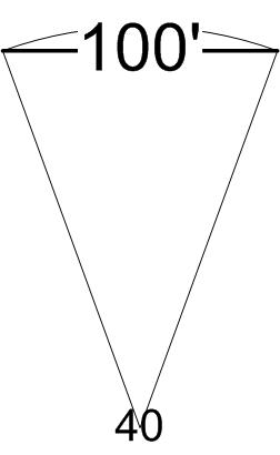
The B&CC blends standards from the 3' Colorado Central and the 2' Gilpin Tramway. While the colorado central used a maximum curve of 40°, the Gilpin Tram used a minimum curvature of radius of 60 feet (about 8 inches in scale). For those wondering, a curve specification in degrees states the amount of arc a 100 foot chord covers.

A 40° curve has about a 146 foot radius (a little more than 20 inches in scale). Lastly, the smallest "standard" turnout is the #4, which has a diverging rail radius of 99' (a little more than 13.5 inches in scale). From this, I decided that my minimum curvature would be 16" and that I'd use both #4 stubs and symmetrical #4 three way stubs for turnouts.
For gradient, I used the Colorado Central figure of 4.5 percent as a ruling grade.
Initial Design
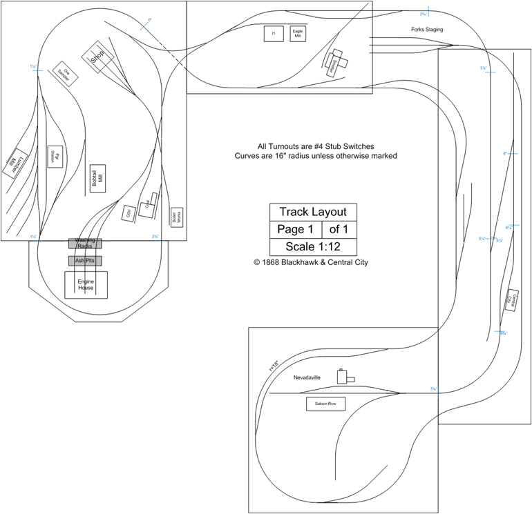
Armed with these standards, my next step was to examine the Colorado Central and Gilpin Tramway trackage in Gilpin County. The mill industries, lower Blackhawk design start from these sources. The Upper Blackhawk and Central City trackage is pure freelance with the Upper Blackhawk engine servicing facilities being based on those suggested by Armstrong’s book. Structures are either based on the actual structures shown in the available Sanborn maps of the area, with appropriate backdating or from other contemporary sources. These prototypical scenes were treated as “shadowboxes” and moved around the layout space until they fit (sometimes with extensions or modification to the prototypical trackage). Grades were inserted to ensure the trackage would have clearance as it folded over itself. The original plan (click for a full image):

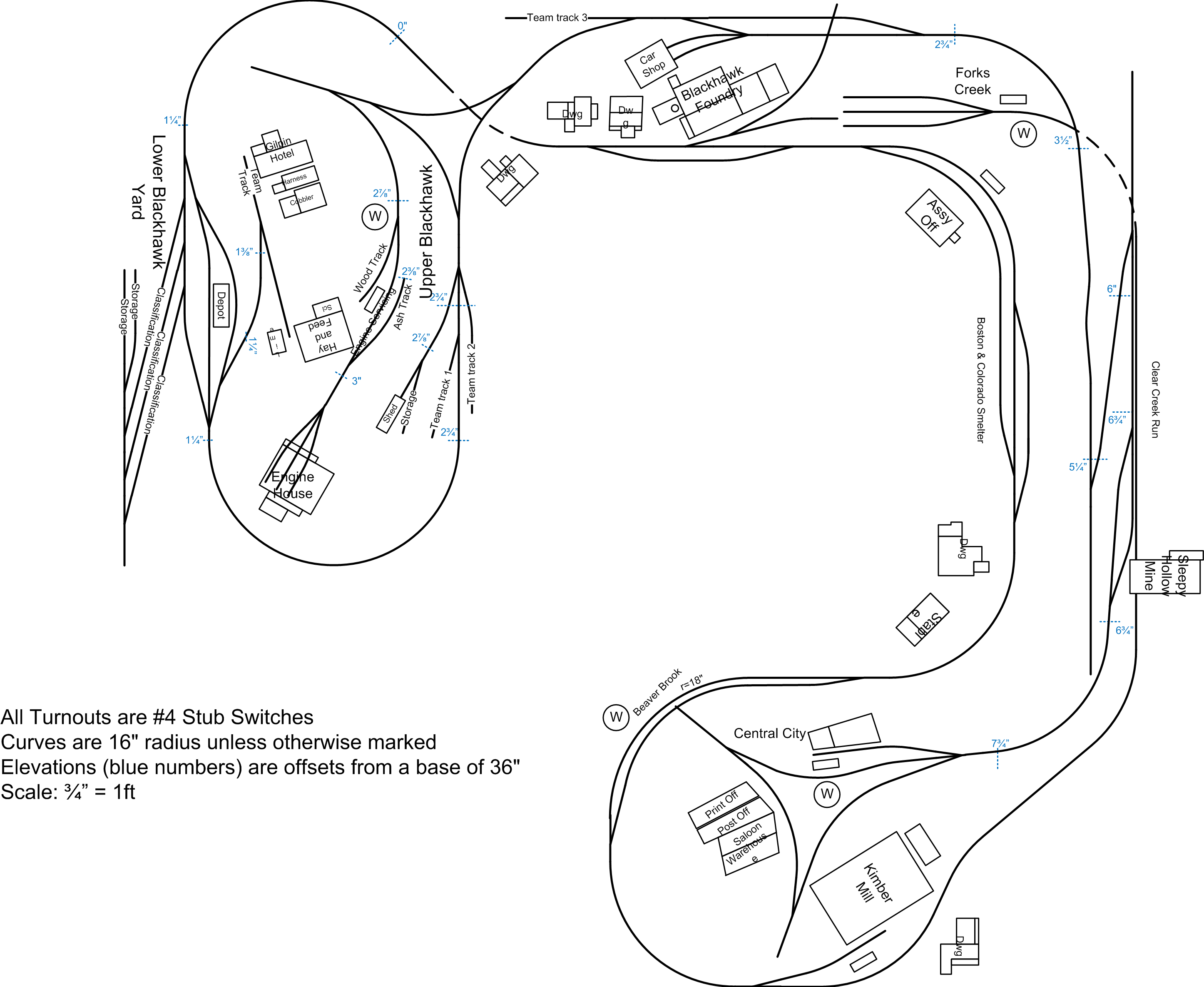
However the truism that “no design survives the first cut of wood” also applied - especially as I used the paper design as a “suggestion” for where the track should go and let the hand laying process determine the final route (updating the layout as I went) – more on this below. In addition, as one of my “givens” was to allow for prototypical operations, I took the extra step of printing a scale paper copy and simulating operating sessions to see if the design could be improved. During this process I decided to modify the concept of building track all the way to Nevada - that would shortchange Central City and so designations were changed, in effect shortening the run to terminate in Central City (and adding another industry). The resulting layout (again click for a full image):

In fact, this layout has undergone some more changes as I've worked on industries - trackage hasn't changed, only the names of the spots.